Approximate Reading Time: 5 minutes. Hike’s level of difficulty: 8/10.
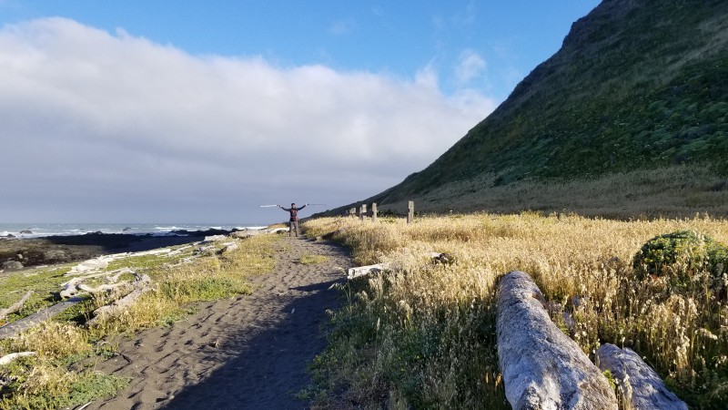
Picture: Me, somewhere along the Lost Coast Trail.
“Nah man. I couldn’t do it. My lungs would collapse or something …”, Keith said, before taking another puff off of his ‘doobie*’.
He must’ve been 17 (at least that is what the budding beard on his face suggested), had an extraordinarily deep voice. Keith and Ron sat outside the General Store 17 rugged miles away from the Mattole Campground, our first rest-spot on California’s infamous Lost Coast Trail.

The Plan: We chose to hike the 25 mile southern most portion of the lost coast, southbound from Mattole beach to to Shelter Cove. The winds blow from North West direction, typically helping Southbound hikers.
Most moderately experienced backpackers plan to hike this trail in 4 night stays – we planned the same (Mattole, Randall Creek, Big Creek, Gitchell Creek).
Tip: Get your permits from Recreation.gov ahead of time – they fill up fast. We had to wait 19 months to get ours!
Almost two years ago, Breck (Aspinwall) and I had contemplated hiking this trail when we met on another trip in the Pt. Reyes wilderness area. While Breck had already been hiking all over the country for decades, I was barely getting started and wanted to do a 2-3 day long hike to build up the skills. Lost Coast sounded just perfect looking at the mileage (25 miles) and was by the ocean (my favorite). The pictures we’d seen online looked gorgeous, and none of the challenges mentioned seemed untenable. But were they? We were about to find out 🙂
Tip: No blogs or travel experiences or videos will will prepare you for what you will have to endure on this trail. The beauty and the wilderness you will experience comes at a cost. Our rule of thumb: multiply the level of difficulty of warned challenges with 5 to get a true sense of what you are getting into! Ask us if you need specific information.
It had been a little past 6 pm by the time we made it to the general store and the kitchen right next door had already shut their grill down. But upon heeding to our pleas for one last fatty meal before the hike, Dave (the owner), got the fryer re-started. While our delicious sandwich was being prepped, we talked some more with Keith, Ron, and Cyrus (an ivy league scholar who was traveling across California interviewing hikers for his thesis). By Sun set time, we were already at the beach, savoring our delicious high calorie meals before setting up tents for the night.


Day 1: Setting up camp at the Mattole beach, right around Sun Set. There are designated sites a bit inland from the beach but we decided to camp right on the beach behind a sand dune to get the purest oceanic experience.
The night was uneventful, with the exception of occasional high gusts of wind that shook the tents and woke us up. Having read about the high tide zones, and knowing that we had to cross the first one of those (4 miles long) the next day, we set out to start very early (530 am) the next day. This would give us enough time to get to Randall Creek, our next campsite safely through a manageable 1.5 ft tide (an average hiker would cover the coast at 1.5 miles per hour, but YMMV depending on the day, the weather, and how tired you are).
Tip: Do NOT underestimate the need to study the predicted tide chart before heading out for this hike. This is not a joke – you may get stranded between high tides and a steep rocky cliff for hours unable to move at all!
We started out at 6 am (about a half hour later than planned), on a beautiful morning next day, unaware of what waited us around the bends. As if the pristine sands were not hard enough for our sinking feet, an army of 2-4 feet tall slippery and pointy rocks soon greeted us in light of a rising Sun.


Day 2: Crossing the first ‘high-tide’ impassable zone. This was absolutely the most challenging part of the trail. Countless slippery rocks with no ‘give-ins’ as you try to find the next foot landing while wind gusts pull you and your 35 lbs backpack off balance. In some places, there was literally no other place to set foot but on a pointy edge or a slippery sea weed infested flat face! Imagine navigating through an endless field of landmines, with only one misstep separating a 35 lbs backpack heavy ‘you’ from a fall-injury, or drowning in a sweeping wave.


Day 2: Interesting sightings along the way. A star fish, whale bones, a metal part next to the first lighthouse we found, playful seals, a bleached crab, and a unique sea creature.
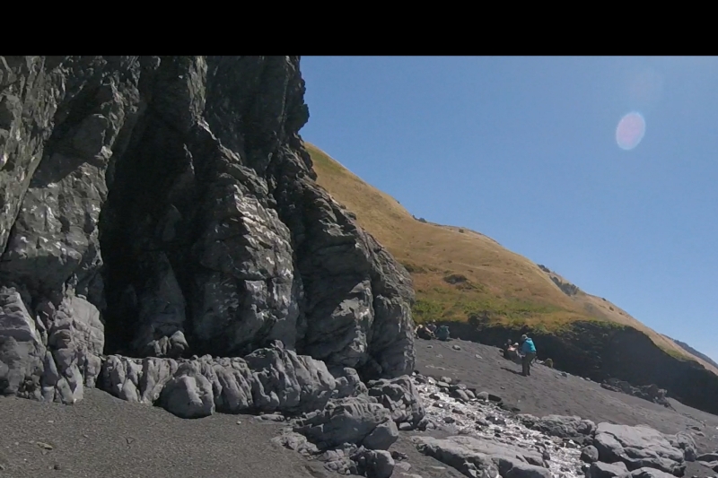
By about 1050 am, we thought we were past the first danger zone, until we hit this rock with no way around it:
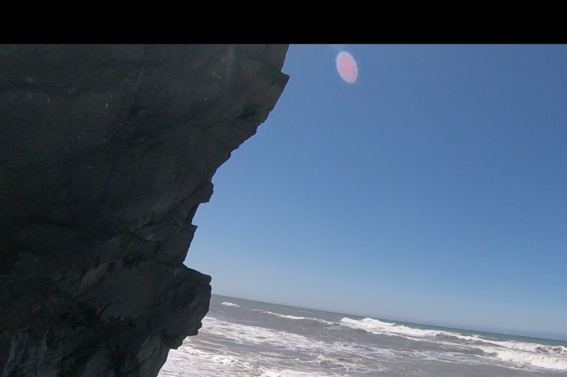
Day 2: The last impassable area of the 4 mile long first high tide zone.
Not knowing what is around the corner (another impassable rock farm, or a tide pool), we faced two very different choices: to continue forward, scuttle around the rock as the next wave recedes, or hike back to a slightly safer place and wait there for the high tide to subside (5 hours).
We decided to take the risk, and ran past the rock as fast as we could in the 4 seconds the next receding wave allowed us. To our surprise, a beautiful creek (Randall Creek) awaited us – with at least a dozen hikers cheering for us. Apparently we had made it just in time before the waves would start to smash the corner so hard you’d fear getting swept away. There were still two more hikers who crossed in about 15 minutes later, but not without getting all soaked wet with the increasingly wild waves!
Day 2: Randall Creek, past the last impassable rock.
Tip: Time your first day’s hike such that you can cross this rock (the first 7 miles) of the coast in less than 1.5 ft of tide. Note that the tide changes with time of day and with the time of month and year!
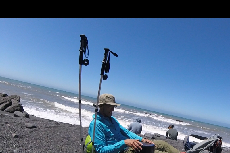
Day 2: Lunch break at Randall Creek. You can see other hikers too, some who camped here that night; the rest kept going farther.
Our sore shoulders and hurting knees heartily welcomed a short lunch break. We exchanged conversations with three other groups. I found the diversity of the groups present there quite interesting! One looked like two college roommate guys, hiking with their surf boards (I cringed at the amount of wind resistance they’d face with a flat board blocking their way!). Another couple was of two professionals who’d come all the way from Los Angeles to hike the coast. A third one was an all girls group that looked very well prepared and equipped. There was also this solo guy who had already hiked the Southbound trail (our plan) and was now hiking back to Mattole beach where his car awaited him!
Tip: If you can afford to, take two cars, park one at the destination trail-head, and the other at the starting point. This way you can control what time you start the hike and can better align your crossing timings with the tide chart. There is a shuttle service between both ends of the trail but it will almost guaranteed not reach the trail head to let you begin the hike before 10 am!
It was only noon, and while we had already reached our planned destination for the day, we decided to continue the hike and cover as much of the next stretch as we could during the afternoon. Fortunately, the next two hours of the trail were mostly on high grounds, with the main challenge being heat from the Sun. It does get pretty from here on though … the California poppy, and the purple wild flowers shine like a blanket!


Day 2: Wildflowers on the high open grounds past the Randall Creek. Heat was starting to make us feel more tired than we were!
Tip: Keep yourself well hydrated. There is a creek every 3 miles or so along the trail, so carry a purifier and enjoy clear, sweet, cold water! Also keep mentally marking the creeks as potential ‘exit’ areas in case you sense difficulty continuing due to health reasons or otherwise!
At a small creek refilling our water containers, we met a very friendly couple who offered us dried mango and apricots for a snack. What a welcome delight! We exchange our jelly beans for some more of their snack and got back on the trail. The trail soon descends from the relatively easy to trek high grounds, to the beach areas. I found the dry sand hardest to walk in, followed by slippery rocks of the first impassable zone.
Tip: Always keep your eye protection glasses on. You will face dry sand gusts right in your face (or worse yet – in your ears from behind). They hurt like a thousand needles at once at 4–50 mph and you definitely don’t want them hurting your eyes!
By about 4 pm, we had made it to the Big Creek. This is where we saw dozens of other hikers pitching tents. This was also the area with the hottest sand so far (and also the windiest as we would learn the hard way soon enough:-). Pitching our tents here was not an easy task. You have to somehow magically be able to put all corner stakes in ground at once or you risk losing your entire tent to the ocean breeze (I actually lost the tent cover this way – it flew away so fast I couldn’t catch it even after giving it a chase!)


Day 2: The trail winds down and away to the beach closer to the Big Creek!
The night here was rough, counter to what we had expected. We had to put huge pieces of rocks on the stakes to keep the tent in place. Breck utilized his experience and created four extra makeshift string supports using wooden logs and spare strings. We were so tired by the time the tents were up they I was ready to crash. But we also wanted to watch the Sun set having made it so far! (We had hiked close to 13 miles in the first day already!)

Day 2: Sun set at the Big Creek.
We decided to not hurry up the next day; to instead take our time to enjoy the creek area and leave the second impassable zone crossing for the next day. However, by 8 am the next day most of the other hikers had already left and it was starting to warm up. So after a quick breakfast, we packed up, and started back on our way to cross as much of the impassable zone as we could that day. Unfortunately, our main camera’s battery had died by now and we could only capture a few pictures along the way.
Tip: You will inevitably suffer muscle aches and weariness. Carry an anti-inflammatory medicine (Advil or Tylenol or Ibuprofen) with you – it will help!
By noon the next day, we had already passed the second impassable zone (woot!) and stopped briefly at Gitchell Creek to eat a quick lunch. At this point, we only had 3.5 miles more to go to our final destination Shelter Cove. This meant that we had already covered close to 10 miles today! This was very encouraging. So even though we were extremely exhausted, with the end in sight, we decided to continue the hike. The next 2 miles were relatively easy to cover. But the last 1.5 miles sucked every remaining bit of energy out of us. The Black Sand Beach, though wide and gorgeous, had never ending patches of dry sinking sand. The heat from the Sun and the high breeze with the tide weren’t helping either. We probably took almost 5 breaks in the last mile … and it was not until 3pm that we saw a glimpse of the staircase that takes you to the Shelter Cove trail-head parking lot. Excited, we pushed the last bit and as soon as we got to the stairs, screamed with joy! Two passersby even congratulated us (one even hugged us) on the accomplishment:-)


")
Final Day: Mixed pictures, including Breck, another camper, and my well deserved dinner after taming the 25 miles trail in 2 days!
For the remaining 3 hours, we drove, overjoyed, getting to the North end of the trail to pick up the second car, found a motel in Garberville, and headed to Cecil’s Louisiana style dining room for a hearty dinner. And boy did it taste good – highly recommended, with or without the hike!
We ended our trip with a tasty breakfast at the Flavor’s Coffeehouse before I headed home to surprise my daughter a day ahead of the schedule (well, it was Father’s Day after all, and was motivation enough for us both to push a 4 day hike into 2 days).
So there’s a memoir of our strenuous Lost Coast hike with a happy ending. We hope you found it useful, and will be more encouraged than deterred from taming this trail in your own unique ways.
Happy hiking!
Prash.
Pictures by both Prash and Breck. (Please do not reuse without our permission (ask us please!)
Notes:
- All the names (except those of the author and the photographer) used in this memoir have been changed to respect the privacy of those described.
- “*Doobie’ is a slang term for a Marijuana cigarette. The author does not promote or encourage smoking or vaping of any kind.